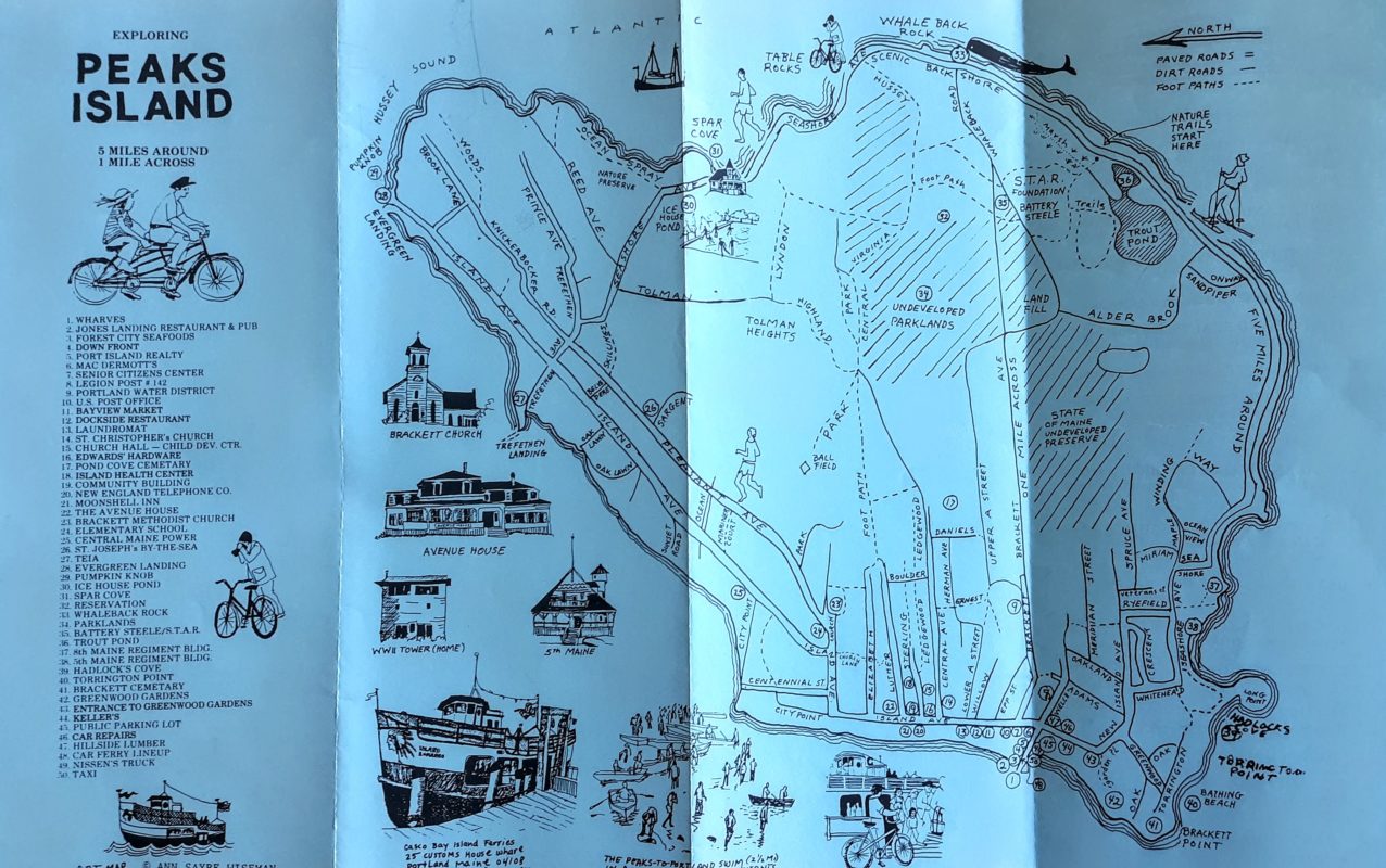
Maps are rich historical sources that can help people visualize the past, and how geographic places have changed over time. The Fifth Maine Museum collection contains many maps, plans, and surveys, and they document how Peaks Island’s land was used over the past 150 years. Map, Exploring Peaks Island, circa 1980. This ephemeral map …
Continue reading “Plots, Plats, and Surveys: Mapping Peaks Island”


